🎉 Up to 70% Off Selected ItemsShop Sale
Northern Ireland OS Laminated Maps
Designed for tourist and leisure activities, each shows details of roads, footpaths, woods, water features, important buildings, historical features and height, making them ideal for planning a day out.
Key features
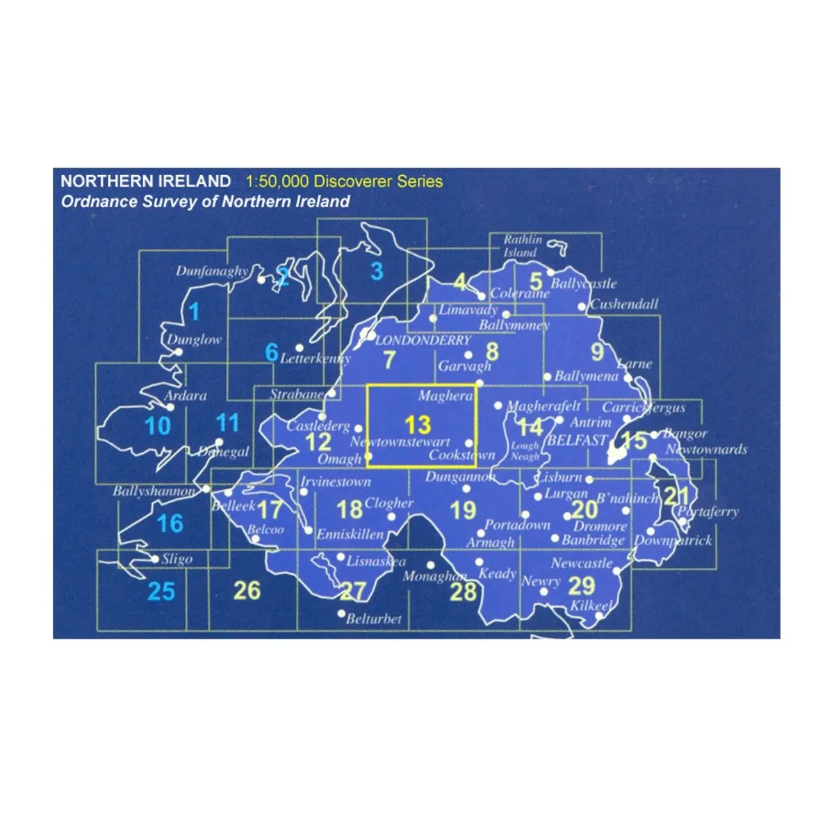
- each map covers an area of 40km x 30km and is based on the Irish Grid co-ordinate system
- the Discoverer series is fully compatible with the Republic of Ireland Discovery series, using the same sheet numbering system, same co-ordinate system, same data source in the border areas and a similar cartographic style and feature content
- the Discoverer series contains important tourist information including youth hostels, picnic areas, view points, camp sites and shows road classification, way marked walks, paths and numbered national cycle networks
- the Discoverer series shows water features such as loughs, rivers and canals with names, as well as beaches and marshes
- easy to use legend printed in English, French and German
- relief is shown in easy to read coloured layers and includes contours at 10m intervals
Select Size
Select Colour
From $6.00
Original: $20.00
-70%Northern Ireland OS Laminated Maps—
$20.00
$6.00Product Information
Product Information
Shipping & Returns
Shipping & Returns
Description
Designed for tourist and leisure activities, each shows details of roads, footpaths, woods, water features, important buildings, historical features and height, making them ideal for planning a day out.
Key features
- each map covers an area of 40km x 30km and is based on the Irish Grid co-ordinate system
- the Discoverer series is fully compatible with the Republic of Ireland Discovery series, using the same sheet numbering system, same co-ordinate system, same data source in the border areas and a similar cartographic style and feature content
- the Discoverer series contains important tourist information including youth hostels, picnic areas, view points, camp sites and shows road classification, way marked walks, paths and numbered national cycle networks
- the Discoverer series shows water features such as loughs, rivers and canals with names, as well as beaches and marshes
- easy to use legend printed in English, French and German
- relief is shown in easy to read coloured layers and includes contours at 10m intervals